Description
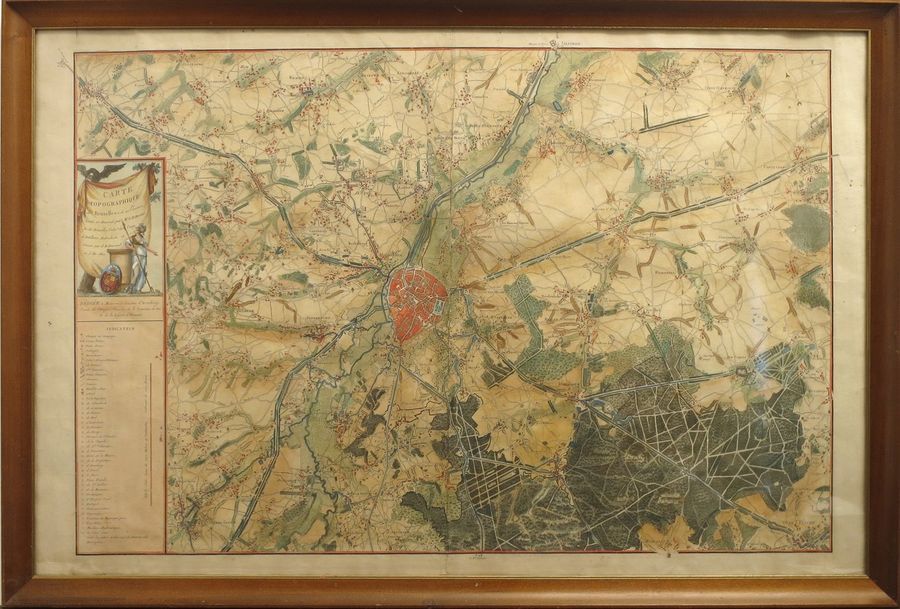
2 maps. 2 engravings, 56,5 x 86 and 49,5 x 59 cm, coloured (central foldings). Framed. 1. DE WAUTIER, Guillaume. Carte topographique de Bruxelles et de ses environs [...]. Brussels, s.n., [1814 or later]. Interesting map of Brussels and its surroundings engraved by J.B. Jouvenel and dedicated to Louis-Engelbert d'Arenberg. Fourth state mentioning Arenberg as senator, but with "A Porte Napoléon" in the legend, as in the 2nd state. - 2. VISSCHER, Nicolaus. Brabantiae ducatus cum adjacentibus provinciis. [Amsterdam], P. Schenk Jun., [after 1775]. Engraved by G. van Gouwen. Ref. Lemoine-Isabeau.- La cartographie du territoire belge de 1780 à 1830. (Travaux du Centre d'Histoire militaire, 29). Brux., 1997, pp. 152, 293-4. - Koeman III: 110.
606
2 maps. 2 engravings, 56,5 x 86 and 49,5 x 59 cm, coloured (central foldings). Framed. 1. DE WAUTIER, Guillaume. Carte topographique de Bruxelles et de ses environs [...]. Brussels, s.n., [1814 or later]. Interesting map of Brussels and its surroundings engraved by J.B. Jouvenel and dedicated to Louis-Engelbert d'Arenberg. Fourth state mentioning Arenberg as senator, but with "A Porte Napoléon" in the legend, as in the 2nd state. - 2. VISSCHER, Nicolaus. Brabantiae ducatus cum adjacentibus provinciis. [Amsterdam], P. Schenk Jun., [after 1775]. Engraved by G. van Gouwen. Ref. Lemoine-Isabeau.- La cartographie du territoire belge de 1780 à 1830. (Travaux du Centre d'Histoire militaire, 29). Brux., 1997, pp. 152, 293-4. - Koeman III: 110.